Auckland's rapid urban expansion over the past two decades, especially on the fringe of the volcanic field, has pushed development onto terrain with highly irregular subsurface conditions. The city sits atop the Auckland Volcanic Field, with over fifty eruption centres creating a chaotic mix of basalt flows, tuff rings, scoria cones, and interbedded sedimentary layers. We use electrical resistivity and vertical electrical sounding (VES) to map these complex shallow stratigraphies without drilling. Before mobilising a rig, a resistivity survey can delineate the contact between a buried lava flow and the underlying Waitemata Group sandstone, saving significant time in the investigation phase. The method is particularly effective for locating perched water tables trapped between basalt and clay, which we often encounter in suburbs like Mount Eden and Three Kings. Combining this data with a geotechnical study gives a complete picture before foundation design begins.
A resistivity survey can delineate buried lava flow contacts and perched water tables without drilling, reducing investigation time in Auckland's volcanic terrain.
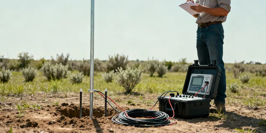
Method and coverage
What we see most often in Auckland is that the volcanic soils have high resistivity contrasts against the surrounding soft sedimentary rock. A typical VES array in the central isthmus uses electrode spacings of up to 80 metres to reach depths of 25–30 metres, enough to cross the weathered basalt crust and reach the firm pumiceous sandstone. The survey produces a 1D resistivity profile that we correlate with existing borehole logs from nearby projects. We apply the Schlumberger array for most urban sites because it reduces lateral noise from buried utilities. The equipment is IP‑compliant and meets NZS 4402‑06 standards. We also cross‑check results with MASW surveys when seismic site classification is required simultaneously. The combined interpretation reduces the chance of misidentifying a stiff clay as weak rock — a common pitfall when relying on drilling alone in Auckland's mixed geology.
Technical reference image — Auckland
Regional considerations
Comparing the volcanic slopes of Mount Albert with the flat reclaimed land of the Viaduct Basin illustrates why resistivity surveys matter in Auckland. On the slopes, the risk is a thin soil cover over massive basalt — drilling alone may miss the contact depth. In the Viaduct area, the risk is saline groundwater infiltration from the harbour, which lowers resistivity and can mislead engineers into thinking the ground is softer than it is. A resistivity survey picks up both scenarios: high resistivity on the volcanic slope indicates rock close to surface, while very low resistivity near the harbour flags saltwater intrusion. Without this geophysical check, foundation designs risk being over‑ or under‑conservative, both of which carry significant cost implications in Auckland's high‑value real estate market.
Apparent resistivity vs. AB/2 curves, inverted 1D model
Data inversion software
IPI2Win / Res2DInv (2D if profile extended)
Applicable ground
Dry to moist soils, rock, basalt, tuff, sand
Related services
01
Vertical Electrical Sounding (VES) – 1D
Single‑point resistivity soundings using Schlumberger array to map vertical layering, depth to basalt, and groundwater table. Ideal for small residential sites in volcanic suburbs.
02
2D Electrical Resistivity Tomography (ERT)
Multi‑electrode profile along a straight line up to 200 m long. Used for detecting lateral variations such as fault zones, old stream channels, or buried lava tubes in Auckland's volcanic field.
03
Time‑Lapse Resistivity Monitoring
Repeated surveys over weeks or months to track changes in moisture content or groundwater level. Applied on slopes with known instability risk, such as the Manukau Harbour cliffs.
04
Resistivity for Corrosion Assessment
Low‑resistivity measurements at 1.5 m depth to evaluate soil corrosivity for buried steel piles or pipelines. Commonly required on commercial sites near the waterfront in downtown Auckland.
Standards that apply
NZS 4402‑06 (Standard Test Method for Field Measurement of Soil Resistivity), NZS 4203:1992 (General Structural Design and Design Loadings – seismic provisions), NZGS Geotechnical Engineering Standard (Minimum requirements for geotechnical investigations)
FAQ
How does electrical resistivity help in Auckland's volcanic geology?
Auckland's volcanic soils have a distinct resistivity signature: dry basalt and scoria show high resistivity (500–2000 Ω·m), while saturated tuff and clay show low resistivity (10–50 Ω·m). A VES profile can pinpoint the contact between these layers, helping engineers decide whether to found on rock or use deep piles. It also identifies perched water tables trapped between lava flows, which are common in suburbs like Mount Eden and Three Kings.
What is the typical cost range for a resistivity survey in Auckland?
For a standard VES survey on a residential site in Auckland, the cost typically ranges between NZ$1,120 and NZ$1,740 depending on the number of soundings, site access, and required depth. Larger 2D ERT profiles or surveys in remote areas may be higher. We always provide a fixed quote after a site walkover.
Can resistivity replace drilling on my site?
No — resistivity is a geophysical method that provides indirect information about subsurface properties. It complements drilling by guiding borehole locations and reducing the number of holes required. In Auckland's complex volcanic ground, a resistivity survey can reduce the drilling programme by 20–30% while still meeting NZGS minimum investigation requirements.
How deep can a VES survey reach in Auckland soils?
With a standard 80 m electrode spacing, we achieve a depth of investigation of approximately 25–30 m, which covers most shallow foundations, basalt flows, and the top of the Waitemata Group sandstone. For deeper investigations (e.g., for large commercial buildings or bridge piers), we extend spacing up to 120 m to reach 40–50 m depth.