New Zealand's geotechnical framework NZS 3404 and the NZGS field guidelines set the benchmark for erosion assessment, and in Auckland these standards are especially critical given the region's steep volcanic terrain and high annual rainfall exceeding 1,200 mm. A proper soil erosion analysis in Auckland must integrate local geology — from Waitematā Group sandstones to East Coast Bays Formation mudstones — with site-specific hydrology to predict surface runoff behaviour. Before approving any earthworks consent, Auckland Council requires quantitative erosion models, and our team routinely pairs this assessment with geotechnical instrumentation to monitor slope pore pressures and drainage geotechnical design to control concentrated flow paths.
Auckland's annual rainfall erosivity index (R-factor) ranks among the highest in New Zealand, making erosion modelling a non-negotiable step in any earthworks consent.
Method and coverage
The humid subtropical climate of Auckland accelerates both sheet and rill erosion on exposed cuts, particularly during the wet season from May to October when monthly rainfall averages 110-140 mm. This forces our soil erosion analysis in Auckland to account for seasonal infiltration cycles and the dispersive nature of certain Northland Allochthon clays that lose strength rapidly when saturated. The methodology follows the Revised Universal Soil Loss Equation (RUSLE2) adapted for New Zealand conditions, incorporating factors for rainfall erosivity (R-factor around 900-1,200 MJ·mm·ha⁻¹·h⁻¹), soil erodibility (K-factor measured via modified Emerson aggregate test), and slope length-gradient. Combined with on-site permeability testing, these inputs allow us to model sediment delivery rates and design effective sediment retention basins compliant with Auckland Council's TP90 guidelines.
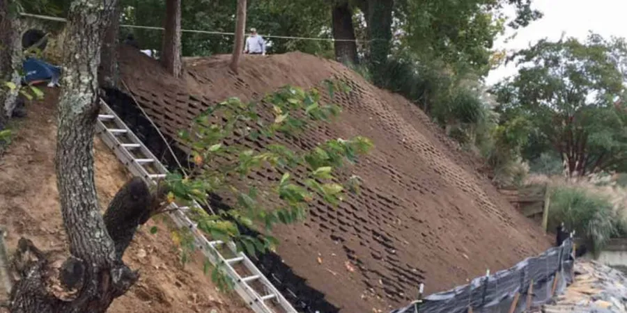
Technical reference image — Auckland
Regional considerations
Auckland sits on the Auckland Volcanic Field with over 50 monogenetic cones, and the residual soils derived from basalt scoria are notoriously prone to gully erosion once the vegetative cover is stripped. Combine that with the region's seismic hazard factor Z = 0.13 (per NZS 1170.5) and you have a scenario where post-earthquake erosion from liquefaction-induced lateral spreading can strip entire hillslopes. Furthermore, coastal erosion along the Manukau Harbour and Hauraki Gulf is accelerating with sea-level rise projections of 0.5–1.0 m by 2100, directly threatening cliff-top developments in suburbs like St Heliers and Ponsonby. A solid soil erosion analysis in Auckland must therefore incorporate both rainfall-driven and seismically triggered erosion mechanisms to satisfy council consent conditions.
We apply RUSLE2 and SEDNET models calibrated with Auckland-specific rainfall data to predict soil loss rates, sediment delivery, and design effective sediment retention basins. This service includes GIS-based slope analysis and on-site soil erodibility testing.
02
Coastal & Volcanic Slope Erosion Assessment
Focused on Auckland's coastal cliffs and volcanic cone slopes, this service combines geomorphic mapping, infiltration testing, and stability analysis to evaluate erosion risk under both normal rainfall and storm events. Deliverables include erosion hazard zoning and mitigation recommendations.
This service complements our laboratory testing work for a complete project analysis.
Standards that apply
NZS 3404 (earthworks & erosion control), NZGS Field Guidelines for Soil Erosion Assessment (2023), Auckland Council TP90: Erosion and Sediment Control Guide, AS/NZS 1289.3.8.1: Soil dispersion test
Process video
FAQ
What is the difference between sheet erosion and gully erosion, and why does it matter in Auckland?
Sheet erosion removes a uniform layer of topsoil across a slope, while gully erosion concentrates flow into deep channels that can undermine structures. In Auckland's volcanic soils, gully erosion is the more aggressive form because the scoria-derived material lacks cohesion once saturated, leading to rapid headcut retreat. Our analysis distinguishes both mechanisms to design appropriate erosion control measures.
How does the soil erosion analysis integrate with Auckland Council's consent process?
Auckland Council requires a site-specific erosion and sediment control plan (ESCP) under the TP90 guide for any earthworks exceeding 2,500 m³. Our analysis provides the quantitative erosion risk assessment needed to inform the ESCP, including sediment basin sizing calculations, diversion drain design, and stabilisation timing. Council typically reviews the model inputs and assumptions before granting consent.
How much does a soil erosion analysis in Auckland typically cost?
For a standard residential site in Auckland (0.5–2.0 ha) the cost ranges between NZ$1,520 and NZ$4,830, depending on site complexity, the number of erosion models required, and whether field tests (e.g., Emerson dispersion, infiltration) are needed. Larger subdivision projects with multiple catchments can exceed this range. We provide a fixed-price quote after an initial site review.
What happens if erosion is detected during construction?
If erosion is observed during earthworks, we perform an immediate site inspection to classify the erosion type (sheet, rill, or gully) and assess the risk to adjacent properties and waterways. Mitigation measures include temporary diversion drains, sediment fences, hydroseeding, or geotextile covers. Our report documents the findings and updates the ESCP accordingly to prevent recurrence.
Location and service area
We serve projects across Auckland and surrounding areas.