Auckland's rapid expansion since the 1950s has pushed development onto the volcanic field's varied terrain — from basalt flows to soft marine sediments. Understanding what lies beneath is critical, and seismic tomography (refraction/reflection) provides a non-invasive way to map layer boundaries, weathered zones, and potential cavities across large sites. We typically run 2D refraction lines along proposed building footprints to correlate seismic velocities with rock quality, then integrate those profiles with MASW-Vs30 data for a complete stiffness picture. The method works well on Auckland's typical 5-15 m of residual clay and weathered basalt before reaching sound rock.
Seismic tomography captures lateral variability that point borings miss — essential for Auckland's interbedded volcanic and marine layers.
Method and coverage
What we see most in this city is variability over short distances — a single site can transition from competent basalt to soft tephra within 30 m. Seismic tomography (refraction/reflection) captures that lateral change better than point borings alone. We deploy 24-48 channel arrays with 2-5 m geophone spacing, generating P-wave and S-wave velocity sections down to 30-50 m depth depending on energy source. The technique is especially useful when paired with microtremors HVSR to confirm resonant frequencies on soft layers. Data processing follows NZS 4402 for refraction and D7128-18 for reflection, with tomographic inversion using curved-ray algorithms to handle velocity inversions common in Auckland's interbedded geology.
Technical reference image — Auckland
Regional considerations
A 15-story apartment complex on Auckland's isthmus recently faced unexpected rockhead variations. The design assumed uniform basalt at 8 m based on two boreholes, but seismic tomography (refraction/reflection) later revealed a buried valley with weathered tephra extending to 22 m. That meant pile lengths doubled for half the building. The client avoided a costly redesign because the survey was done before foundation tenders went out. In our experience, the risk is real: missing a paleochannel or a lava tube cavity can shift foundation costs by 30% or more. We always recommend seismic lines spaced at 20-30 m across the site to catch those features early.
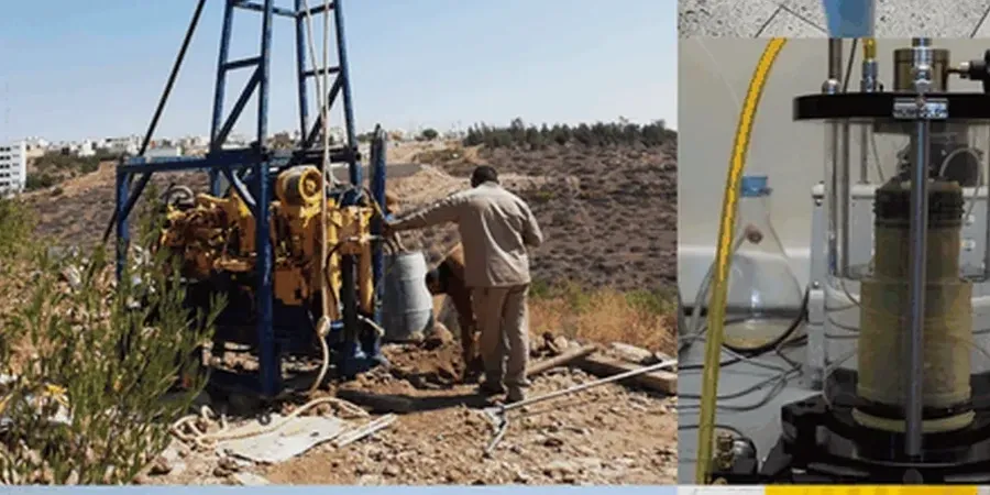
First-arrival tomography using 24-48 geophones with 2-5 m spacing. Delivers velocity-depth sections for bedrock depth, rippability assessment, and excavation classification. Best for greenfield sites with expected depth < 30 m.
02
2D Reflection Profiling (P-wave)
High-resolution common-midpoint (CMP) reflection for resolving thin layers and steep dips. Uses a sledgehammer or weight drop with 48 channels and 1-2 m geophone spacing. Ideal for identifying buried channels, faults, or lava tubes in Auckland's volcanic terrain.
03
Combined Refraction/Reflection (P & S-wave)
Simultaneous acquisition of P-wave and S-wave data using horizontal geophones and shear-wave sources (plank or shear hammer). Provides Vp/Vs ratios for lithology classification and Poisson's ratio estimates. Recommended for seismic site class assessment per NZS 1170.5.
Standards that apply
NZS 4402 (Standard Guide for Refraction Seismic Method), NZS 4402 (Standard Guide for Reflection Seismic Method), NZGS 2023 Geotechnical Site Investigation Guidelines (Section 6.3: Geophysical Methods)
FAQ
What is the difference between seismic refraction and reflection tomography?
Refraction tomography uses first-arrival travel times of P-waves that travel along layer boundaries, best for mapping velocity gradients and depth to competent rock. Reflection tomography uses reflected arrivals from discrete interfaces, resolving thin layers and steep dips that refraction may miss. For Auckland's interbedded geology, we often run both on the same line to cross-validate results.
How deep can seismic tomography survey in Auckland's volcanic soils?
Depths of 10-30 m are typical with a sledgehammer source on residual clays and weathered basalt. With an accelerated weight drop (100-200 kg), we can reach 40-50 m in favorable conditions. The depth depends on source energy, ground coupling, and near-surface attenuation — Auckland's dense clay layers often provide good coupling for deeper penetration.
How much does seismic tomography cost in Auckland?
A typical 2D refraction survey with one line of 48 geophones (120 m long) ranges between NZ$4.570 and NZ$8.840, including field acquisition, processing, and a report with velocity sections. Reflection surveys cost more due to higher channel counts and processing time. The price varies with site access, number of lines, and required depth.
When should I choose seismic tomography over standard boreholes?
Seismic tomography is ideal for sites with suspected lateral variability — volcanic paleochannels, buried valleys, or lava tube cavities — where point borings might miss critical features. It also works well for large area coverage (multiple hectares) where drilling every 20 m is cost-prohibitive. We typically recommend tomography as a reconnaissance tool before drilling to optimize borehole locations, saving time and cost.
Location and service area
We serve projects across Auckland and surrounding areas.